Natural Catastrophes
Finance, Investment & Risk Management
Earthquakes & Seismic Hazards
Economic Loss & Disaster Risk Financing
Insurance & Risk Management
Joint Research Initiative
France
2020.11.29
New Probabilistic Assessment of Seismic Hazard, Losses and Risks in Strong Seismic Prone Regions
Assessing seismic hazard and their economic and human losses is of high relevance, both scientifically, for insurers, and for communities at risk. According to the World Health Organization, the urban population will continue to grow by approximately 1.5% to 1.6% per year from 2015 to 2030. It is estimated that earthquakes will cause about 2.8 million casualties worldwide by the end of the 21st century. Indeed, because of the long return periods of the largest high-consequence earthquakes, and because few urban areas have yet to suffer such major events in their current configuration, the greatest earthquake disasters appear to lie in the future.
As an insurer, AXA has been developing its own expertise on Natural Catastrophes (NAT-CAT) since 2014. Natural catastrophes are, however, very complex risks to model and accurate loss estimates require in-depth knowledge about the underlying physics. For this reason, the development of internal NAT-CAT models has been supported by scientific partnerships.
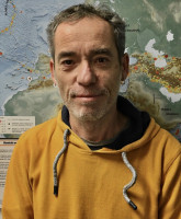
One of them is the research project conducted by the team led by Dr. Philippe Guéguen, Research Director at the Institut des Sciences de la Terre (ISTerre) at the University of Grenoble Alpes (France). This project is being carried out in collaboration with the AXA Group Risk Management team within the framework of an AXA Research Fund Joint Research Initiative (JRI)
The two-step research process will focus on Europe and on South America, an area prone to earthquake risk and where AXA’s exposure is significant:
Hazard assessment including GPS data:
In strong seismic prone regions, such as subduction environments, magnitude-frequency distributions are assessed mostly from instrumental datasets of moderate earthquakes, extrapolated for larger events with maximum magnitudes inferred from scaling laws. Although these catalogs extend over several centuries, the observation time windows are often short with respect to the recurrence times of moderate-to-large events and the recurrence models can be weakly constrained because of the lack of information on the seismic fault segmentation. .
The academic team will use GPS data both for proposing a segmentation of the interface and for estimating probabilities of occurrence of future earthquakes, making assumptions on the part of the deformation released in transient events
Loss and risk assessment using open-source data and artificial intelligence tools:
Modeling the economic consequences of natural disasters has gained importance in recent years. Earthquake loss models can provide relevant information for decision and policy makers. Moreover, the benefits of rapid and effective economic and human loss estimate models can be of the utmost importance in the immediate aftermath of earthquake disasters. Developing relevant earthquake loss models is challenging, because most economic and human loss models are based on post-earthquake interpretations, and the empirical relationships are derived from field observations that include substantial uncertainties. Magnitude and distance are the two key parameters in the control of the impact of an earthquake in an urbanized area. However, even moderate earthquakes have caused considerable economic losses and fatalities due to the vulnerability of buildings. There is a consensus on the importance of building damage as a contributing factor to losses and on the need to consider regional vulnerability models. Post-earthquake observations systematically show a strong correlation between losses (economic and social) and building damage.
The academic teams will use machine-learning techniques to develop new vulnerability, loss, and fatality models. To achieve this goal, they will use both the latest releases of exposure open-source databases (OpenStreetMap, OpenBuildingMap, etc.) and data collected after past earthquakes. Such models are expected to be more appropriate than the HAZUS model for the studied areas (South America and Europe) and more compatible with the type of data available in open-source databases (i.e., global characteristics instead of technical building features).
April, 2021

Philippe
GUEGUEN
Institution
Université Grenoble Alpes
Country
France
Nationality
French
Related articles
Natural Catastrophes
Climate Change
Wildfires
Climate Adaptation & Resilience
Global Warming
AXA Chair
Greece
AXA Chair in Wildfires and Climate
The consequences of climate change have never been as substantial and visible in such a wide range of places around ... Read more

Apostolos
VOULGARAKIS

