Natural Catastrophes
Earthquakes & Seismic Hazards
Floods & Tsunamis
Ph.D
France
2009.09.30
Seismic and tsunami risk in Northern Chile
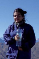
The goal of Amaya Fuenzalida is to better assess seismic hazards in her native country. She focuses part of her study on Northern Chile, where the latest very large earthquake occurred in 1877 and induced one of the most destructive tsunami in history. Since 1877, energy has accumulated due to plate convergence.* The Tocopilla earthquake in 2007 released some of this energy, but according to seismologists, the worst is yet to come! To assess present-day seismic risk in Northern Chile, Fuenzalida fi rst needed to know all about the 2007 Tocopilla event... and luckily she had an unprecedented amount of high quality data available. Indeed, the Tocopilla earthquake was recorded by an extensive monitoring network, installed by French, German and Chilean institutions working in collaboration with each other.
Fuenzalida also tries to evaluate the effects of a potential future event similar to that of 1877, including the risk for a tsunami that could spread across the Pacifi c. In parallel, Fuenzalida works on the Maule earthquake, which occurred during her PhD, in 2010, in Southern Chile. She led fi eld work to collect data about the aftershocks of this event and is currently analyzing them. Large Chilean earthquakes can cause numerous fatalities and have a high economical cost. In 1985, an earthquake in Central Chile produced an economic negative impact of nearly 2% of the Gross National Product. Fuenzalida's study might be useful for the mitigation of seismic hazards by Chilean authorities, and contribute to reducing their harmful consequences.
My research focuses on On 14 November 2007 an earthquake of magnitude 7.8 struck the region Tocopilla in northern Chile. This earthquake relieved only a fraction of the cumulated strain due to the plate convergence since the historical Chile–Peru earthquake in 1877 : only 2 to 3 m of slip was deduced from the records, whereas 10 m was due. This means that there is still a potential for a new destructive earthquake, possibly more large and expected to trigger a strong and destructive tsunami. Now, my research work is to use all available seismic data of permanent and temporary networks to characterize the source of the earthquake and its major aftershocks. The first part of my Ph.D. was it location, determination of focal mechanisms and magnitudes evaluation through inversion methods of the seismic waves.
CHILE: THE WORLD LEADER IN MEGA EARTHQUAKES
Can you describe your research project?
My thesis is based on the study of one of the most seismically active zones in the world: Chile. The country is located in the subduction zone between the South American Plate and the Nazca Plate, two plates which are moving towards each other at a rate of around 7 cm per year. This convergence produces a build-up of pressure over several decades: the accumulated energy can be released very quickly and powerfully, and can cause enormous damage, as we have just seen in the 8.8-magnitude earthquake of 27 February 2010 near the city of Concepción (the strongest to hit Chile since 1960, when the country suffered the most powerful earthquake ever recorded).
What is a seismic gap?
A seismic gap is an area which has produced significant seismic activity in the past and so is known to be an active zone, but which has not ruptured in a long time. In Chile, the two seismic gaps are the “Northern Gap”, between the town of Arica and the Mejillones Peninsula, and the “Southern Gap”, which has just ruptured, between the town of Valparaiso and the Arauco Peninsula.
What are the long-term prospects for your research?
Once we have analysed the data, we will know more about the rupture process and the distribution of the aftershocks, and will then be able to start assessing the potential seismic risk in the region. This new information will also be particularly helpful in addressing the risks of the “Northern Gap”, as much for earthquakes as for tsunamis, so that more resources can be allocated to natural disaster warning systems and government procedures.

To add or modify information on this page, please contact us at the following address: community.research@axa.com

Amaya
FUENZALIDA-VELASCO
Institution
Ecole Normale Supérieure
Country
France
Nationality
Chilean
Related articles
Extreme Weather Events
Space & Planetery
Floods & Tsunamis
Remote Sensing & Earth Monitoring
Post-Doctoral Fellowship
Italy
2023.09.01
Mitigating Tsunamis’ Threats and Destructive Impacts Through Enhanced Navigation Satellite System
Over the last century, 58 tsunamis occurred around the world. Accordingly, those events are rare, but each has a powerful... Read more

Michela
RAVANELLI
Sapienza University of Rome
Natural Catastrophes
Climate Change
Wildfires
Climate Adaptation & Resilience
Global Warming
AXA Chair
Greece
AXA Chair in Wildfires and Climate
The consequences of climate change have never been as substantial and visible in such a wide range of places around ... Read more

Apostolos
VOULGARAKIS
